Evapotranspiration over Complex Roughness
Evapotranspiration (ET) modulates the diurnal cycle of land surface energy balance and is the largest source of water loss from our freshwater systems. Currently there is a significant knowledge gap in our understanding about the dynamics of ET over complex roughness elements and sparse canopies.
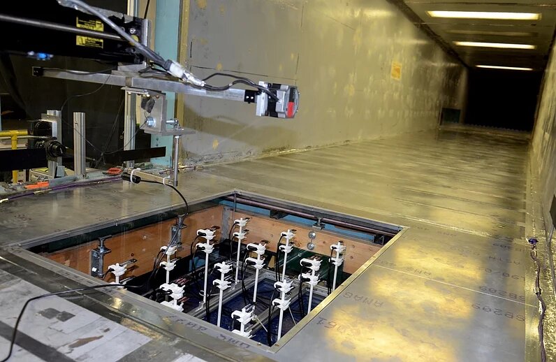
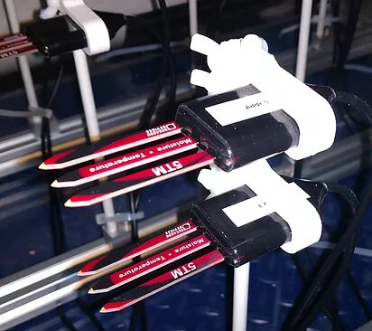
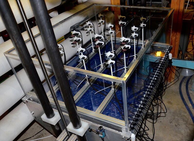
The team is initiating a new research direction to better understand the impacts of spatial distribution of complex configuration of sparse roughness elements and canopy trees on diurnal cycle of the latent heat fluxes though state-of-the-art laboratory experiments. This involves designing a new wind tunnel test section to formalize the effects of roughness elements on aerodynamic and soil evaporative resistances as well as developing a new roughness-aware ET model.
This work will close our knowledge gaps in understanding the effects of sparse canopy on diurnal variability of ET and soil moisture fluxes. For the first time, this research will demonstrate how the vapor fluxes can be probabilistically parametrized as a function of spacing and density of sparse canopy roughness. This project has the potential to have a major impact on theory by introducing a new ET model for reasoning about the uncertainties of flux-profile methods over sparse canopy.
The outcomes will benefit water conservation, sustainable agriculture and wind energy systems, and remote sensing of ET. The new model could enable optimal configuration of canopy windbreaks for minimization of water loss in irrigated agriculture and lead to roughness-aware algorithms with reduced uncertainty in remote sensing of ET.
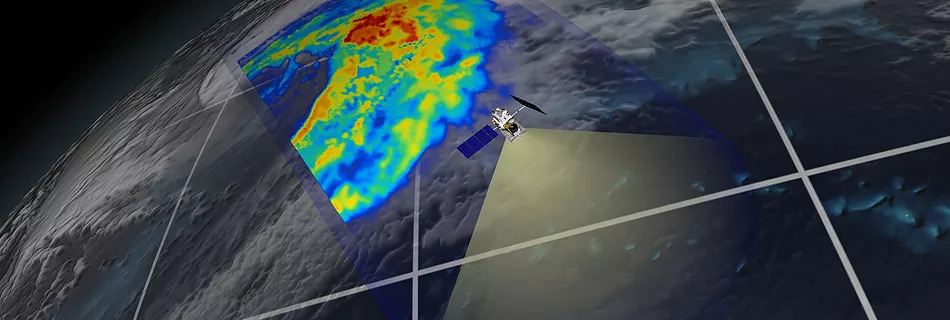
Estimation of precipitation from space is one of the most important and challenging problems in earth remote sensing. It turns out that the upwelling earth radiation in microwave bands contains spectral signatures of precipitation profile at top of the atmosphere allowing us to measure global precipitation variability from space. In the past few years, our team has developed a modern passive retrieval algorithm to obtain improved estimates of precipitation from space using passive radiometric measurements provided by the Tropical Rainfall Measuring Mission (TRMM) and Global Precipitation Measurement (GPM) satellites. This algorithm relies on manifold learning via sparse approximation and promises improved retrieval of extreme and light precipitation, especially over land and at the vicinity of coastlines. Read more ...
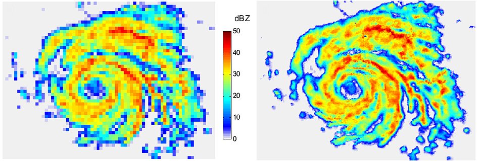
In remote sensing of natural processes, details of interest might not be fully captured due to technical and cost constraints. Increasing the resolution of remote sensing imageries is of particular importance to obtain improved estimates of small-scale but important features of earth processes (e.g., precipitation extremes, tornadoes). Unlike the past efforts, via stochastic random generators for downscaling of geophysical fields, our team has developed downscaling methods, which rely on sparse approximation techniques. Applying our sparse downscaling algorithms, evidence suggests that the proposed sparse downscaling techniques can effectively recover high-resolution natural signals of interest (e.g., precipitation) while properly preserving their spatial coherency. Read more
Assimilation of observations into numerical models of environmental systems allows us to improve the estimates of their initial conditions and extend their forecast skills. Our team has contributed in developing modern theoretical frameworks in variational data assimilation in transform domains. The objective is to design data assimilation techniques that remain effective under limited number of sub-sampled observations (Ebtehaj et al., 2014). We have also been involved in large-scale assimilation of remotely sensed precipitation and soil moisture data into the land surface-atmosphere models. The research along this line aims to develop large-scale systems to assimilate satellite observations into coupled numerical models of land-atmospheric (see Lin et al., 2015) and crop models to optimize agricultural water management. Read more...

Assimilation of observations into numerical models of environmental systems allows us to improve the estimates of their initial conditions and extend their forecast skills. Our team has contributed in developing modern theoretical frameworks in variational data assimilation in transform domains. The objective is to design data assimilation techniques that remain effective under limited number of sub-sampled observations (Ebtehaj et al., 2014). We have also been involved in large-scale assimilation of remotely sensed precipitation and soil moisture data into the land surface-atmosphere models. The research along this line aims to develop large-scale systems to assimilate satellite observations into coupled numerical models of land-atmospheric (see Lin et al., 2015) and crop models to optimize agricultural water management. Read more...